Komentáře mohou vkládat pouze registrovaní uživatelé.
Před vložením komentáře je nutné se buď přihlásit, nebo zaregistrovat.
754.049-5 | |
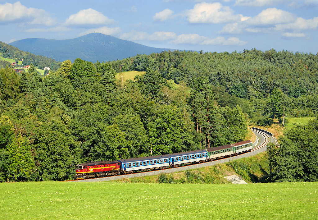 | Informace o fotografii: - Úsek: Kunčice pod Ondřejníkem - Frenštát pod Radhoštěm - GPS: 49°32'19.118"N, 18°15'56.747"E » - Datum: 7.8.2016 - Autor: Tomáš Krajcar  - Pozn.: Os 3140 - Zobrazeno: 3613x - Detailní EXIF informace » - Rating od autorů: 10 - Rating od uživatelů: 8 |
| Abyste mohli hodnotit, musíte se přihlásit | |
07.12.2017 (18:19)
Nepletu se, že ten kopec s tím vysílačem je Lysá Hora?
Komentáře vyjadřují názory čtenářů.
Redakce nenese žádnou zodpovědnost za jejich obsah.
![]() - akreditovaný fotograf nebo člen ŽP,
- akreditovaný fotograf nebo člen ŽP, ![]() - správce galerie nebo admin ŽP
- správce galerie nebo admin ŽP
Přidat komentář
Logowanie
© 2001 - 2026 ŽelPage
- administratorzy - pytania i odpowiedzi
:. Projekty
:. Strony internetowe
:. Kontakty
:. Sledujte nás


Info

informacni okenko